Route O Miradoiro
 TECHNICAL DATA
ROUTE: linear.
DISTANCE: 11,5Km.
ACCUMULATED ALTITUDE: 681m.
DIFFICULTY: Medium, by mountain area.
Marks home coordinates: 42.13001', - 8.089752'.
Description: The route can be done on foot, horseback, mountain bike or all terrain car.
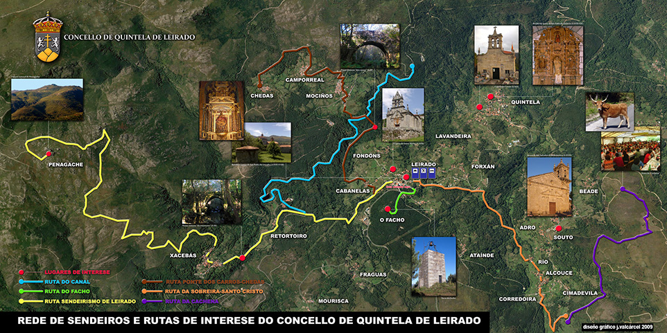
The trail starts in front of the Town Hall, where is placed the explanatory panel on the route. From here we take the road towards Xacebans, the start is on asphalt that we continue for approximately 2 Km. until you reach the junction of the road which goes from Bande to Notaria, there beside some warehouses abandoned and demolished, called Os Garaxes. We began the walk along a narrow path surrounded by pine trees, oaks, birches and native vegetation of great natural beauty, that leads to a hidden village called Retortoiro, the trail passes on one side of it but we can easily accessible through a road in about 20 minutes. Following the route between meadows and farmland dwindled, we go down towards the Deva river, presenting a good natural pools for swimming, though the water is very cold, because the shadows of the trees on the banks to prevent the arrival of sunshine.
It is crossed by a sturdy stone bridge and following the course of the Deva river begins a continuous ascension with occasional ledges, in cobbled pieces and sometimes on the ground, generally wet, which flows into another stoned and going to Xacebans, the last village of this route, where you can visit a bar located in the old town community oven or thirst-quenching or cool off in many crystalline water sources what have.
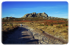
We went through Xacebans until you reach a forest road at the top of the village, which will begin a continuous ascent by a path of dirt road and loose stone, and as it progresses up the landscape is going to widen. The highlight is arriving at Penagache, which identifies perfectly by the cross that is on top of a huge granitic mass. The trail finishes atop Penagache 1.226 metres above sea level. Landscape can be seen from here is magnificent, may be part of the valleys of the Miño, Arnoia and Deva rivers, and already very far the Limia, San MAMEDE, Alto do Rodicio, the mountains of Larouco...
On the other side of Penagache you will hear water dropping what only will be seen in winter when the volume is increased, is a waterfall in the stream called "Salto do Gato." The legends say that under Penagache and with input for close to this stream there is a cave of the time of the Moors.
Leaving Penagache for one track that now has moments of rest alternating with slopes not as pronounced as the previous ones, the same border opposite road of the framework to reach nº 21.
Taking the variant left, before reaching the Nº 22 in Portuguese territory, you can visit a megalithic burial monument excavated and pretty battered. Almost in front to nº 23 to the left can be seen the stunning picture of the large Mota.
Following to the nº 27 will be the path that comes to Celanova and if approaching until the nº 29 1st which leads to Bande.
DOWNLOAD

 TECHNICAL DATA


